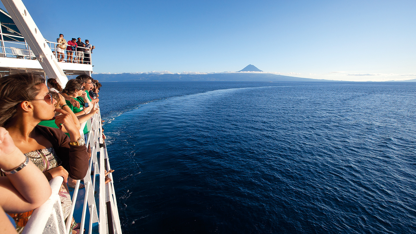


Pico


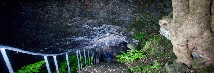
 Torres Cave, the longest lava tube of the Azores
The grey Island
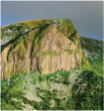
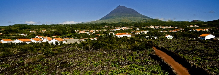
The extensive lava fields that dot the landscape of the island, and that locals calls lajidos or terras de biscoito (cookie land) according to their plain or irregularity, serve as the motto chosen for the color grey of the island. And also the corrals of the vineyard, the maroiços on agricultural land, the paths walls, trails and land divisions refer to this tone, interspersed with green vegetation.
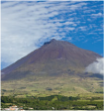
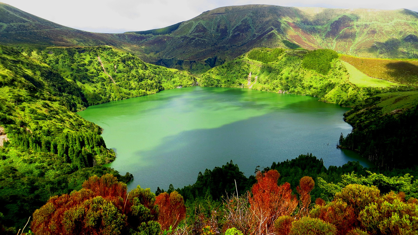
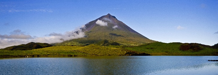
The huge volcanic cone of Pico Mountain rises majestic, cutting the blue of the sky or allowing itself to be rolled in a protective blanket of clouds. To the east of this massive volcano, the island stretches in a long volcanic ridge, with lush patches of endemic flora and green pastures, where are about two hundred small basaltic scoria cones and about twenty lakes. These and other bodies of water, including ponds and bog lands more or less flooded, serve as habitat for the residents and migratory birds, like the grey heron.
Volcanic Landscapes
Imposing, majestic, magnificent, are some of the many nicknames that the Pico Mountain possesses, thanks to its maximum altitude of 2,350 m and 19 km average diameter of sea level. The third biggest volcano in the Atlantic imposes on the landscape of the island, exerting an irresistible attraction for almost of the corners of Pico, and for many sites of the neighbouring islands. In its crater lodges a lava cone known as Piquinho and permanent fumaroles which charge to remember their volcanic nature. At the height of approximately 1,250 metres, where the climb begins to the mountain, one can almost see the entire island including the neighbouring islands of Faial and São Jorge. The climb to the summit provides a great deal of pleasure, due to the extraordinary deed of the climb and to the breathtaking panoramas. On a clear day, there is the additional prize of also viewing the profiles of the islands of Graciosa and Terceira.
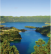
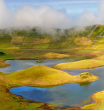
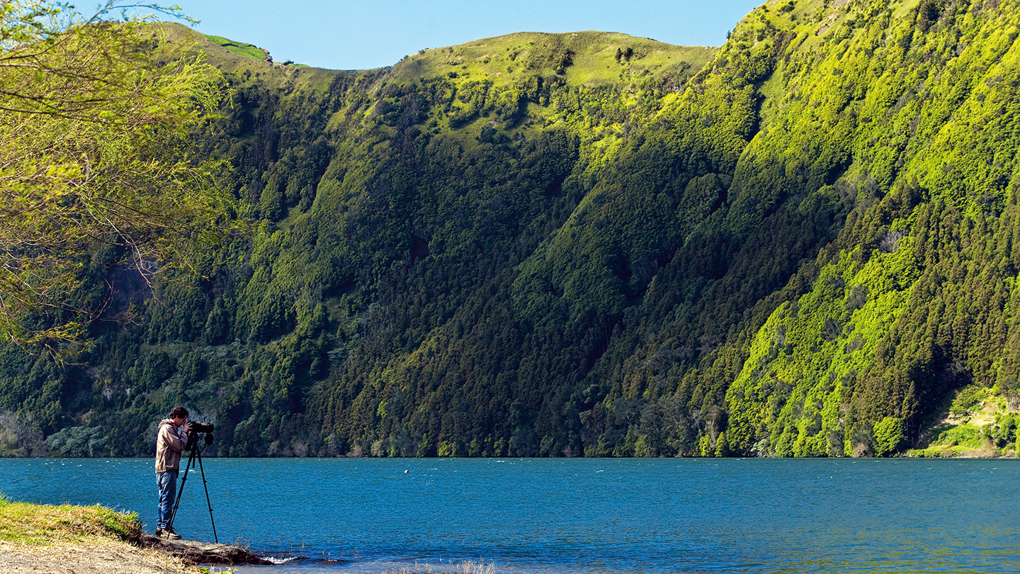
In the eastern half of the island is the Achada Plateau that dominates, with a volcanic ridge with approximately 30 km long between the Capitão Lake and the Ponta da Ilha. Its about 200 volcanic cones and surrounding areas are house for bogs, ponds or lakes as the Grotões, Rosada, Paul, Landoral, Caiado, Peixinho and Negra. This area is one of the most important palces in the Azores in terms of endemic vegetation, cedars, heaths, sanguinho or trovisco in large and dense patches
Although all of these features, the lava fields are the genetic symbol of the island with numerous and diverse proves of volcanic activity which gave birth to the island and the reminiscent of other exotic volcanic islands, the Hawaiian Islands. In some cases, these lava fields are associated with lava eruptions witnessed by people who, fearful, designated Mistérios (mysteries) such rocky terrains that born from the Earth fire. In this way, born the Praínha Mystery (16th century), Santa Luzia, São João and Silveira Mysteries (18th century).
Coastline
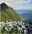
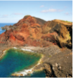
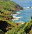
The dark gray basalt, the crystal blue sea and the milky white of foam represents the colourful triology of the coast of Pico Island. No beaches but with beautiful bays and coves, the island offers many bathing areas, often take the advantage of the coastline to provide a unique natural landscape. In contrast, high cliffs mark certain sections of the shoreline of Pico, rivalling those with São Jorge on its marvel and grandiosity: the Terra Alta lookout provides this vision.
Volcanic arches, caves and benches are spread by the litoral coast, giving passage to land of vineyards with their typical wine cellars. In many places of the island, as in Ribeiras, Lajes do Pico or in Ponta do Mistério, widespread lava deltas remain as a eloquent testimony of the constant struggle between the creative power of volcanoes and the destructive actions of the sea.
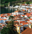
Places to Visit

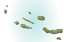
Pico is the second largest island of the Azores, with 444.9 sq. km and with an elongated shape thanks to its 42 km of length and 15.2 km at its maximum width. It is dominated by the Volcano of Pico on its western half, it is 6 km away from the neighboring island of Faial and is populated by 14.148 inhabitants (census 2011). It is the most southerly island of the Central Group of the Azores Archipelago and part of the “triangle islands.” The highest point of the island, at 2350 m altitude, is also the highest point of Portugal, located at 28°23’58’’ longitude west and 38°28’07’’ latitude north.
PICO MOUNTAIN: This majestic volcano dominates the island; the 2.350m high mountain is crowned by the Pico Grande, a rounded crater of about 700m in perimeter and 30m deep. At one end of the crater, the volcanic cone of Piquinho, or Pico Pequeno, with a height of about 70 m, with smoking fumaroles at its base, forms the top of the crater. You can climb Pico but should always be accompanied by a guide.
The grey Island
The extensive lava fields that dot the landscape of the island, and that locals calls lajidos or terras de biscoito (cookie land) according to their plain or irregularity, serve as the motto chosen for the color grey of the island. And also the corrals of the vineyard, the maroiços on agricultural land, the paths walls, trails and land divisions refer to this tone, interspersed with green vegetation.
The huge volcanic cone of Pico Mountain rises majestic, cutting the blue of the sky or allowing itself to be rolled in a protective blanket of clouds. To the east of this massive volcano, the island stretches in a long volcanic ridge, with lush patches of endemic flora and green pastures, where are about two hundred small basaltic scoria cones and about twenty lakes. These and other bodies of water, including ponds and bog lands more or less flooded, serve as habitat for the residents and migratory birds, like the grey heron.
Volcanic Landscapes
Imposing, majestic, magnificent, are some of the many nicknames that the Pico Mountain possesses, thanks to its maximum altitude of 2,350 m and 19 km average diameter of sea level. The third biggest volcano in the Atlantic imposes on the landscape of the island, exerting an irresistible attraction for almost of the corners of Pico, and for many sites of the neighbouring islands. In its crater lodges a lava cone known as Piquinho and permanent fumaroles which charge to remember their volcanic nature. At the height of approximately 1,250 metres, where the climb begins to the mountain, one can almost see the entire island including the neighbouring islands of Faial and São Jorge. The climb to the summit provides a great deal of pleasure, due to the extraordinary deed of the climb and to the breathtaking panoramas. On a clear day, there is the additional prize of also viewing the profiles of the islands of Graciosa and Terceira.
In the eastern half of the island is the Achada Plateau that dominates, with a volcanic ridge with approximately 30 km long between the Capitão Lake and the Ponta da Ilha. Its about 200 volcanic cones and surrounding areas are house for bogs, ponds or lakes as the Grotões, Rosada, Paul, Landoral, Caiado, Peixinho and Negra. This area is one of the most important palces in the Azores in terms of endemic vegetation, cedars, heaths, sanguinho or trovisco in large and dense patches
Although all of these features, the lava fields are the genetic symbol of the island with numerous and diverse proves of volcanic activity which gave birth to the island and the reminiscent of other exotic volcanic islands, the Hawaiian Islands. In some cases, these lava fields are associated with lava eruptions witnessed by people who, fearful, designated Mistérios (mysteries) such rocky terrains that born from the Earth fire. In this way, born the Praínha Mystery (16th century), Santa Luzia, São João and Silveira Mysteries (18th century).
Coastline
The dark gray basalt, the crystal blue sea and the milky white of foam represents the colourful triology of the coast of Pico Island. No beaches but with beautiful bays and coves, the island offers many bathing areas, often take the advantage of the coastline to provide a unique natural landscape. In contrast, high cliffs mark certain sections of the shoreline of Pico, rivalling those with São Jorge on its marvel and grandiosity: the Terra Alta lookout provides this vision.
Volcanic arches, caves and benches are spread by the litoral coast, giving passage to land of vineyards with their typical wine cellars. In many places of the island, as in Ribeiras, Lajes do Pico or in Ponta do Mistério, widespread lava deltas remain as a eloquent testimony of the constant struggle between the creative power of volcanoes and the destructive actions of the sea.
Pico is the second largest island of the Azores, with 444.9 sq. km and with an elongated shape thanks to its 42 km of length and 15.2 km at its maximum width. It is dominated by the Volcano of Pico on its western half, it is 6 km away from the neighboring island of Faial and is populated by 14.148 inhabitants (census 2011). It is the most southerly island of the Central Group of the Azores Archipelago and part of the “triangle islands.” The highest point of the island, at 2350 m altitude, is also the highest point of Portugal, located at 28°23’58’’ longitude west and 38°28’07’’ latitude north.
PICO MOUNTAIN: This majestic volcano dominates the island; the 2.350m high mountain is crowned by the Pico Grande, a rounded crater of about 700m in perimeter and 30m deep. At one end of the crater, the volcanic cone of Piquinho, or Pico Pequeno, with a height of about 70 m, with smoking fumaroles at its base, forms the top of the crater. You can climb Pico but should always be accompanied by a guide.