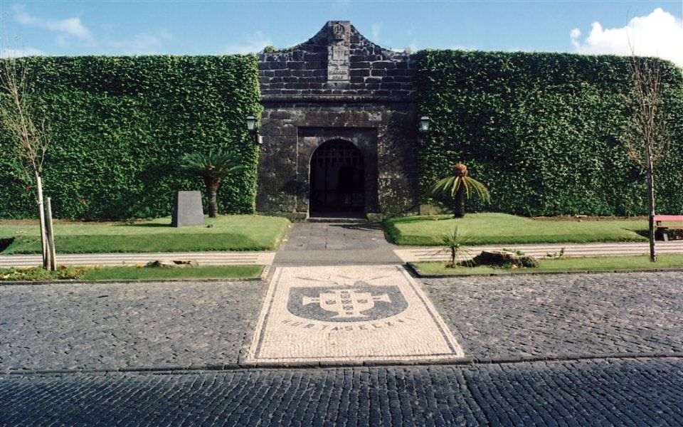


Faial


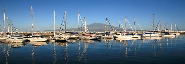
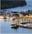
 Horta Marina, an emblematic stopover for yachts crossing the Atlantic
The Blue Island
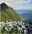
From the lookout of Cabeço Gordo, the ground seems to slide softly until it levels out by the seaside, where a profusion of hydrangeas brings to land the colour of the sea, as if materializing a romance between the blue of the flowers and the green of the vegetation and pastures. The same happens along the road leading to the Caldeira, in the centre of Faial, and on other roads, justifying the nickname of Blue Island. But there is a complete change at the Capelinhos Volcano, with its arid and rough landscape proving that grey can also be charming.
Volcanic Landscape
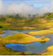
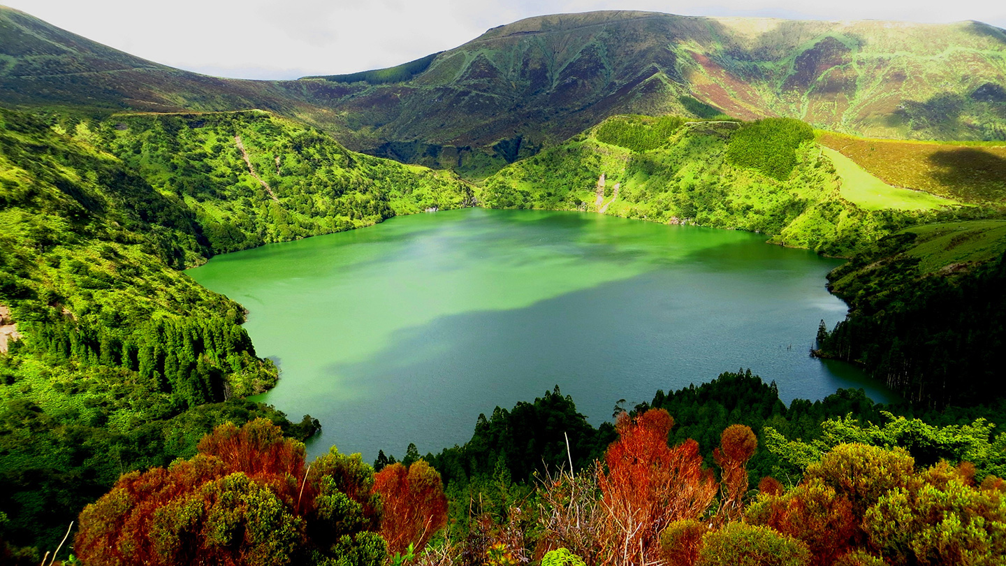
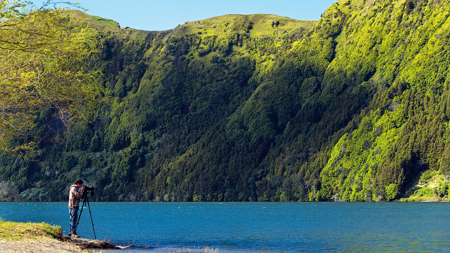
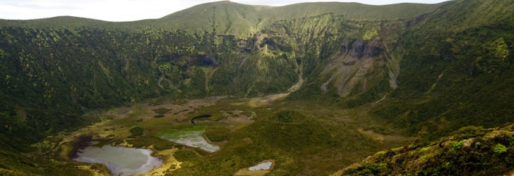
The genetic symbol of the island, the Caldeira is an awesome caldera given its size and because it has so many flowers, plants and trees that shine under the sun light. The 7 km long walls are covered by various plants, including beech tress, junipers, moss, cedars, ferns and hydrangeas. At the bottom, 450 m below the Caldeira lookout, a fragmented lake and a small volcanic cone, with vestiges of the primitive laurissilva forest, dot the landscape in another exciting game of colours.
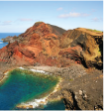
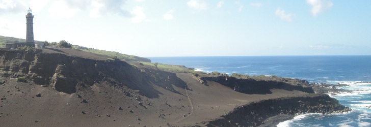
At the westernmost point of the island, the Capelinhos Volcano majestically rises up to the sky, as the witness to the last volcanic eruption that took place in the Azores and that added new land to the existing one. Entering this area is like landing on the moon, with the grey volcanic ash and lapilli tossed out between 1957 and 1958 starting to be invaded by green vegetation, which is determined to colonize this new territory. In the abrupt cliffs of Capelinhos and Costado da Nau, one can see the inside of these volcanoes in a sequence of contrasting rocks, layers and contours and in a game of surprising colours and textures.
A pilgrimage site for the international scientific community, the Capelinhos Volcano forced the emigration of part of Faial’s population, which had to foot the bill for the damage in houses, farms and plantations in a trail of destruction silently witnessed by the old lighthouse tower. Presently, the switched off tower is home to the magnificent Interpretation Centre, featuring the most advanced multimedia and exhibition techniques. The visit ends with a climb to the top of the lighthouse to enjoy an unbeatable emotional and visual experience.
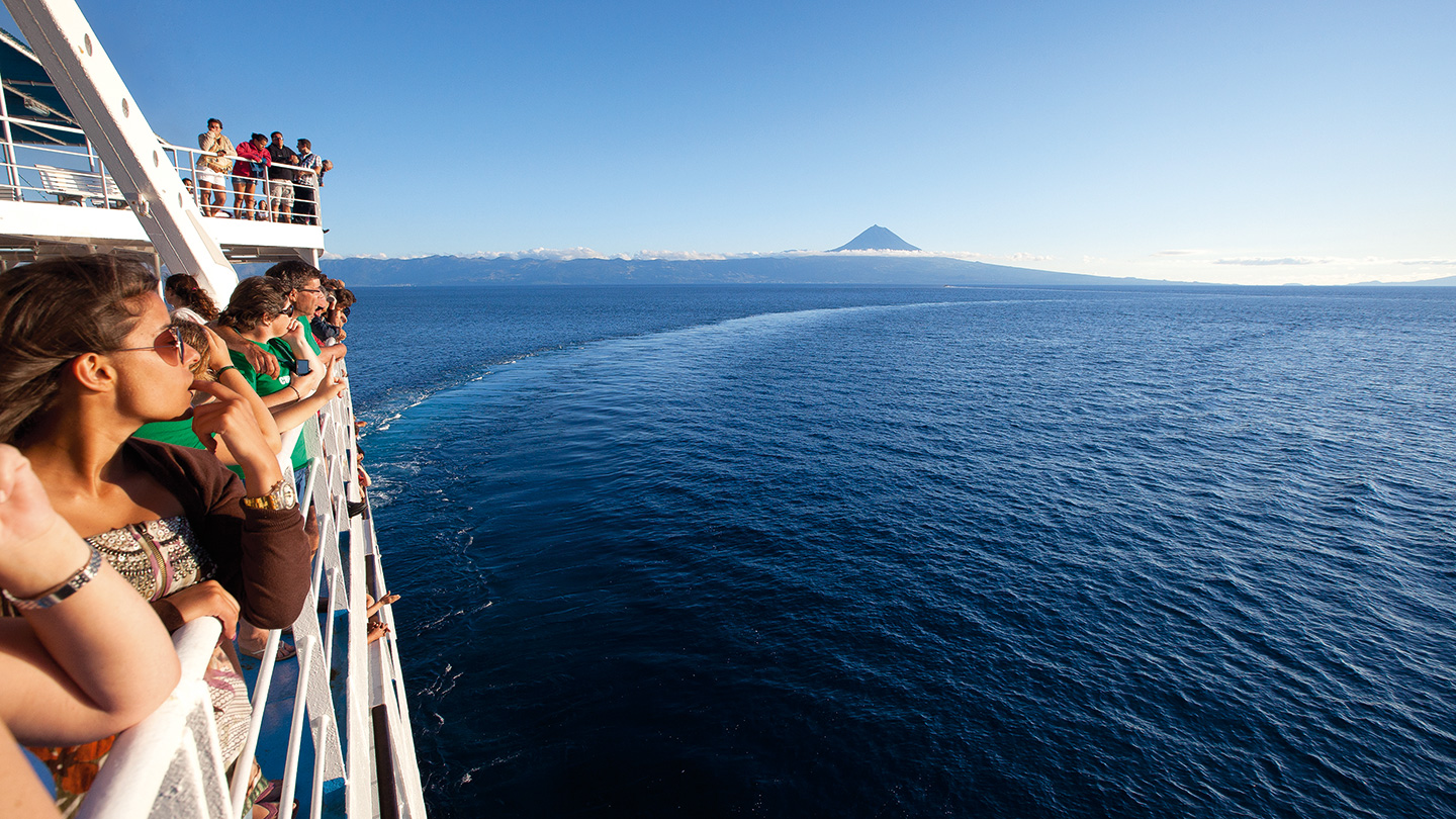
Faial offers great lookouts and views over the neighbouring islands. By the ruins of the Ponta da Ribeirinha Lighthouse, destroyed by the 1998 earthquake, one can enjoy the sublime outline of the island of São Jorge. At Ponta da Espalamaca, in the lookout by the monument of the Saint Nossa Senhora da Conceição and in front of the whole Bay of Horta, the Pico Mountain rises majestically. From Cabeço Gordo, on a clear day, the horizon extends to all the triangle islands and to Graciosa.
Looking inland, great extensions of pasture land come into view; they climb all the way up to the Caldeira, being interrupted here and there by woods and trees. This natural landscape coexists on the island with indelible elements of the human presence, with some typical windmills painted red dotting the landscape, along with flowery and cultivated fields in the Flamengos Valley, and rows of hydrangeas painstakingly aligned along roads or delimiting the fields.
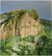
And on the way between Varadouro and Castelo Branco, a rock surrounded by water and sea birds catches our attention. This is the Morro de Castelo Branco [White Castle Hill], which lives up to its name with trachyte white rock and a castle-like shape, as if it was some kind of impregnable fortress.
Coastline
From the Triangle Islands, this is the one that has more volcanic sand beaches; the Porto Pim, Almoxarife and Norte Beaches invite you to enjoy sea bathing. The shape of the east coast varies considerably; sometimes it is high and other times it lies almost at sea level, given the action of gigantic tectonic forces that divide it into several blocks of large dimensions.
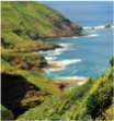
The coastline on the west side of the island is dominated by the imposing cliffs of Ribeira Funda and Praia do Norte and the ones that lie between Morro de Castelo Branco and Varadouro, sharply plunging into the deep ocean. These towering cliffs give way to rocky cliffs at the Capelo Peninsula, which extend west and correspond to the most recent geological formations of the island.
Places to Visit

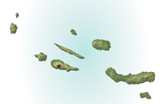
The 21 km in length and 14 km at the maximum width provide the 173.1 sq. km of the island of Faial with a pentagonal shape. Faial is the third most populous island of the Archipelago with 14,994 inhabitants (2011 data). The island is part of the Central Group and is the westernmost corner of the so-called “Triangle Islands”, which also include São Jorge and Pico, the latter just 6 km away from Faial. The island’s highest point is the Cabeço Gordo (1,043 m of altitude) in the Caldeira area located at 38º34’34’’ latitude north and 28º42’47’’ longitude west.
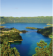
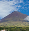
CALDEIRA: A volcanic cone which dominates the island. At the top is a huge crater, 1.450m in diameter and 400m deep, covered in cedar, juniper, Myrica faya, ferns and mosses, part of which are fine samples of the island’s primitive vegetation.
CALDEIRA: A volcanic cone which dominates the island. At the top is a huge crater, 1.450m in diameter and 400m deep, covered in cedar, juniper, Myrica faya, ferns and mosses, part of which are fine samples of the island’s primitive vegetation.
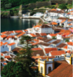
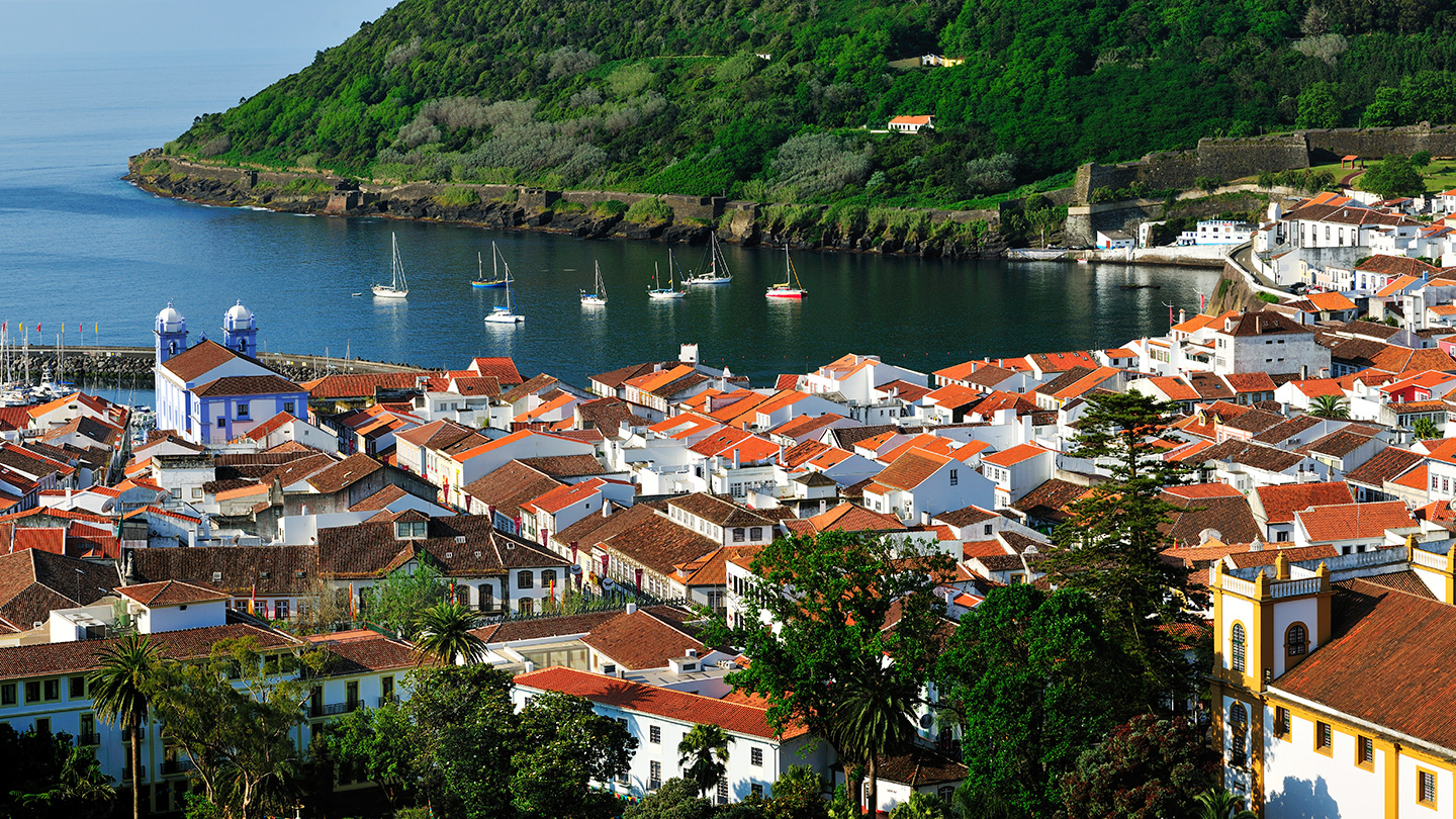
HORTA MARINA: Inaugurated on 3rd June, 1986, this was the first marina to be built in the Azores. As well as providing shelter for Atlantic seafarers, its walls are decorated by colourful paintings, thanks to the imagination and inventiveness of its visitors.
The Blue Island
From the lookout of Cabeço Gordo, the ground seems to slide softly until it levels out by the seaside, where a profusion of hydrangeas brings to land the colour of the sea, as if materializing a romance between the blue of the flowers and the green of the vegetation and pastures. The same happens along the road leading to the Caldeira, in the centre of Faial, and on other roads, justifying the nickname of Blue Island. But there is a complete change at the Capelinhos Volcano, with its arid and rough landscape proving that grey can also be charming.
Volcanic Landscape
The genetic symbol of the island, the Caldeira is an awesome caldera given its size and because it has so many flowers, plants and trees that shine under the sun light. The 7 km long walls are covered by various plants, including beech tress, junipers, moss, cedars, ferns and hydrangeas. At the bottom, 450 m below the Caldeira lookout, a fragmented lake and a small volcanic cone, with vestiges of the primitive laurissilva forest, dot the landscape in another exciting game of colours.
At the westernmost point of the island, the Capelinhos Volcano majestically rises up to the sky, as the witness to the last volcanic eruption that took place in the Azores and that added new land to the existing one. Entering this area is like landing on the moon, with the grey volcanic ash and lapilli tossed out between 1957 and 1958 starting to be invaded by green vegetation, which is determined to colonize this new territory. In the abrupt cliffs of Capelinhos and Costado da Nau, one can see the inside of these volcanoes in a sequence of contrasting rocks, layers and contours and in a game of surprising colours and textures.
A pilgrimage site for the international scientific community, the Capelinhos Volcano forced the emigration of part of Faial’s population, which had to foot the bill for the damage in houses, farms and plantations in a trail of destruction silently witnessed by the old lighthouse tower. Presently, the switched off tower is home to the magnificent Interpretation Centre, featuring the most advanced multimedia and exhibition techniques. The visit ends with a climb to the top of the lighthouse to enjoy an unbeatable emotional and visual experience.
Faial offers great lookouts and views over the neighbouring islands. By the ruins of the Ponta da Ribeirinha Lighthouse, destroyed by the 1998 earthquake, one can enjoy the sublime outline of the island of São Jorge. At Ponta da Espalamaca, in the lookout by the monument of the Saint Nossa Senhora da Conceição and in front of the whole Bay of Horta, the Pico Mountain rises majestically. From Cabeço Gordo, on a clear day, the horizon extends to all the triangle islands and to Graciosa.
Looking inland, great extensions of pasture land come into view; they climb all the way up to the Caldeira, being interrupted here and there by woods and trees. This natural landscape coexists on the island with indelible elements of the human presence, with some typical windmills painted red dotting the landscape, along with flowery and cultivated fields in the Flamengos Valley, and rows of hydrangeas painstakingly aligned along roads or delimiting the fields.
And on the way between Varadouro and Castelo Branco, a rock surrounded by water and sea birds catches our attention. This is the Morro de Castelo Branco [White Castle Hill], which lives up to its name with trachyte white rock and a castle-like shape, as if it was some kind of impregnable fortress.
Coastline
From the Triangle Islands, this is the one that has more volcanic sand beaches; the Porto Pim, Almoxarife and Norte Beaches invite you to enjoy sea bathing. The shape of the east coast varies considerably; sometimes it is high and other times it lies almost at sea level, given the action of gigantic tectonic forces that divide it into several blocks of large dimensions.
The coastline on the west side of the island is dominated by the imposing cliffs of Ribeira Funda and Praia do Norte and the ones that lie between Morro de Castelo Branco and Varadouro, sharply plunging into the deep ocean. These towering cliffs give way to rocky cliffs at the Capelo Peninsula, which extend west and correspond to the most recent geological formations of the island.
The 21 km in length and 14 km at the maximum width provide the 173.1 sq. km of the island of Faial with a pentagonal shape. Faial is the third most populous island of the Archipelago with 14,994 inhabitants (2011 data). The island is part of the Central Group and is the westernmost corner of the so-called “Triangle Islands”, which also include São Jorge and Pico, the latter just 6 km away from Faial. The island’s highest point is the Cabeço Gordo (1,043 m of altitude) in the Caldeira area located at 38º34’34’’ latitude north and 28º42’47’’ longitude west.
CALDEIRA: A volcanic cone which dominates the island. At the top is a huge crater, 1.450m in diameter and 400m deep, covered in cedar, juniper, Myrica faya, ferns and mosses, part of which are fine samples of the island’s primitive vegetation.
CALDEIRA: A volcanic cone which dominates the island. At the top is a huge crater, 1.450m in diameter and 400m deep, covered in cedar, juniper, Myrica faya, ferns and mosses, part of which are fine samples of the island’s primitive vegetation.
HORTA MARINA: Inaugurated on 3rd June, 1986, this was the first marina to be built in the Azores. As well as providing shelter for Atlantic seafarers, its walls are decorated by colourful paintings, thanks to the imagination and inventiveness of its visitors.